Nederland

Flag description three equal horizontal bands of red (top), white, and blue; similar to the flag of Luxembourg, which uses a lighter blue and is longer
![]()
Capital: Lelystad
![]()
![]()
![]()
(the city)
![]()
![]()
![]()
![]()
(Utrecht city)
A bit of Geography of The Netherlands
* * *
Let's put it on the map :-)
Location: The Netherlands is situated in Western Europe, bordering the North Sea, between Belgium
and Germany
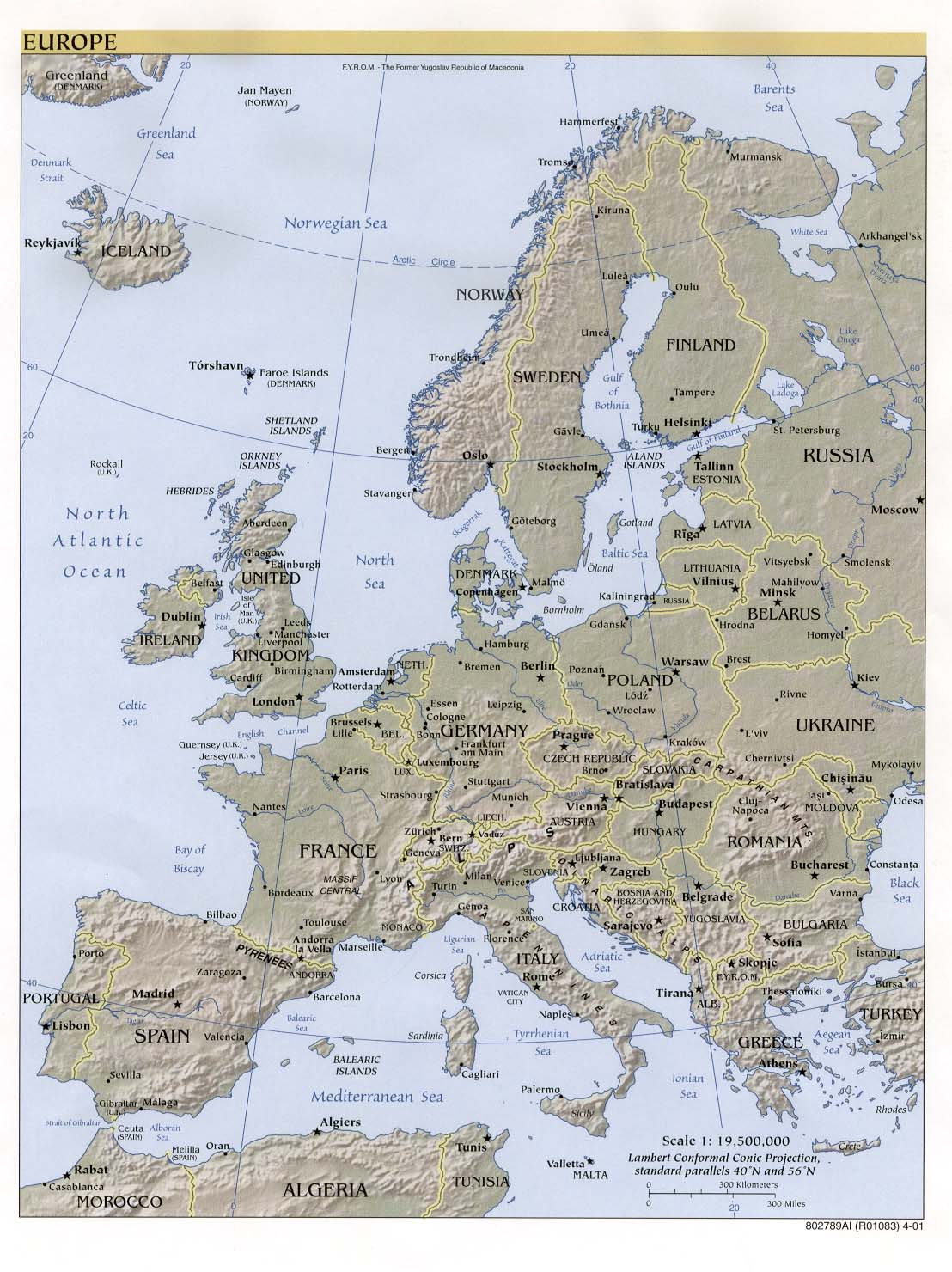
Have a look at this map of Europe and look for The Netherlands "NETH"... It is so small, that there's not even enough space to write the whole name *lol*.
* * *
The Netherlands has 12 provinces:
(If you click on the name of each province
in the table below,
you will find the link to the sound file for the pronunciation)
Vocabulary: (Provinces: provincies, singular -
provincie);
* * *
Take a look at the
Province Map of The Netherlands (click link)
* * *
| The Netherlands Nederland |
Flag description three equal horizontal bands of red (top), white, and blue; similar to the flag of Luxembourg, which uses a lighter blue and is longer
|
Capital: Amsterdam |
|
|
Capital: Assen | |
| Flevoland |
|
Capital: Lelystad
|
| Friesland |
|
Capital: Leeuwarden |
| Gelderland |
|
Capital: Arnhem |
| Groningen |
|
Capital: Groningen (the city) |
| Limburg |
|
Capital: Maastricht |
| Noord-Brabant |
|
Capital: Den Bosch |
| Noord-Holland |
|
Capital: Haarlem |
| Overijssel |
|
Capital: Zwolle |
|
|
|
Capital: Utrecht (Utrecht city) |
|
|
Capital: Middelburg | |
|
|
|
Capital: The Hague |
* * *
Some more facts and specifics:
Geographic coordinates 52 30 N, 5 45 E
Map references Europe
Area
In The Netherlands we calculate our distance in Kilometers;
in short: km. One kilometer equals 1,6
miles. So if you divide the kilometers by 1,6 you have the miles. I always
use the 1,5 for a rough estimate. And, the other way around: If you multiply the
miles by 1,6 you find the distance in kilometers.
total: 41,532 sq km
land: 33,889 sq km
water: 7,643 sq km
Area - comparative slightly less than twice the size of New Jersey
Land boundaries
total: 1,027 km
border countries: Belgium 450 km, Germany 577 km
Coastline: 451 km
Climate temperate; marine; cool summers and mild winters
Terrain mostly coastal lowland and reclaimed land (polders); some hills in southeast
Elevation extremes
lowest point: Prins Alexanderpolder -7 m (below sea level) situated
near Rotterdam
highest point: Vaalserberg 321 m; situated in the South of
Holland, Limburg.
Natural resources natural gas, petroleum, arable land
Land use arable land: 25%
permanent crops: 3%
permanent pastures: 25%
forests and woodland: 8%
other: 39% (1996 est.)
Natural hazards the extensive system of dikes and dams protects nearly one-half of the total area from being flooded
Environment - current issues water pollution in the form of
heavy metals, organic compounds, and nutrients such as nitrates and phosphates;
air pollution from vehicles and refining activities; acid rain
Air pollution by cars, industries etc.
Geography - note located at mouths of three major European rivers (Rhine, Maas or Meuse, and Schelde)
Currency:
Since 2002 the Netherlands use the Euro, like
many other European countries.
* * *
Vocabulary:
Provinces: provincies, singular - provincie
The 12 names of each Dutch province
(see above & sound files)
Kilometers: Kilometers
Web resources:
http://education.yahoo.com/reference/factbook/nl/geogra.html
http://www.provincies.nl/
http://www.lib.utexas.edu/maps/europe/europe_ref01.jpg